CENTRAL ILLINOIS — Following a chilly start to March, a significant weather pattern shift is expected to bring a more active and unsettled stretch of weather to the region. As Illinois observes Severe Weather Preparedness Week (March 2–6), the timing serves as a reminder to stay alert as thunderstorms return to the forecast.
Midweek Storm Potential
While Monday remains mostly cloudy and cool, a warm front will begin pushing northward late tonight, setting the stage for the first round of rainfall.
-
Tuesday Night Focus: A marginal risk of excessive rainfall has been highlighted for all of Central and Southeast Illinois.
-
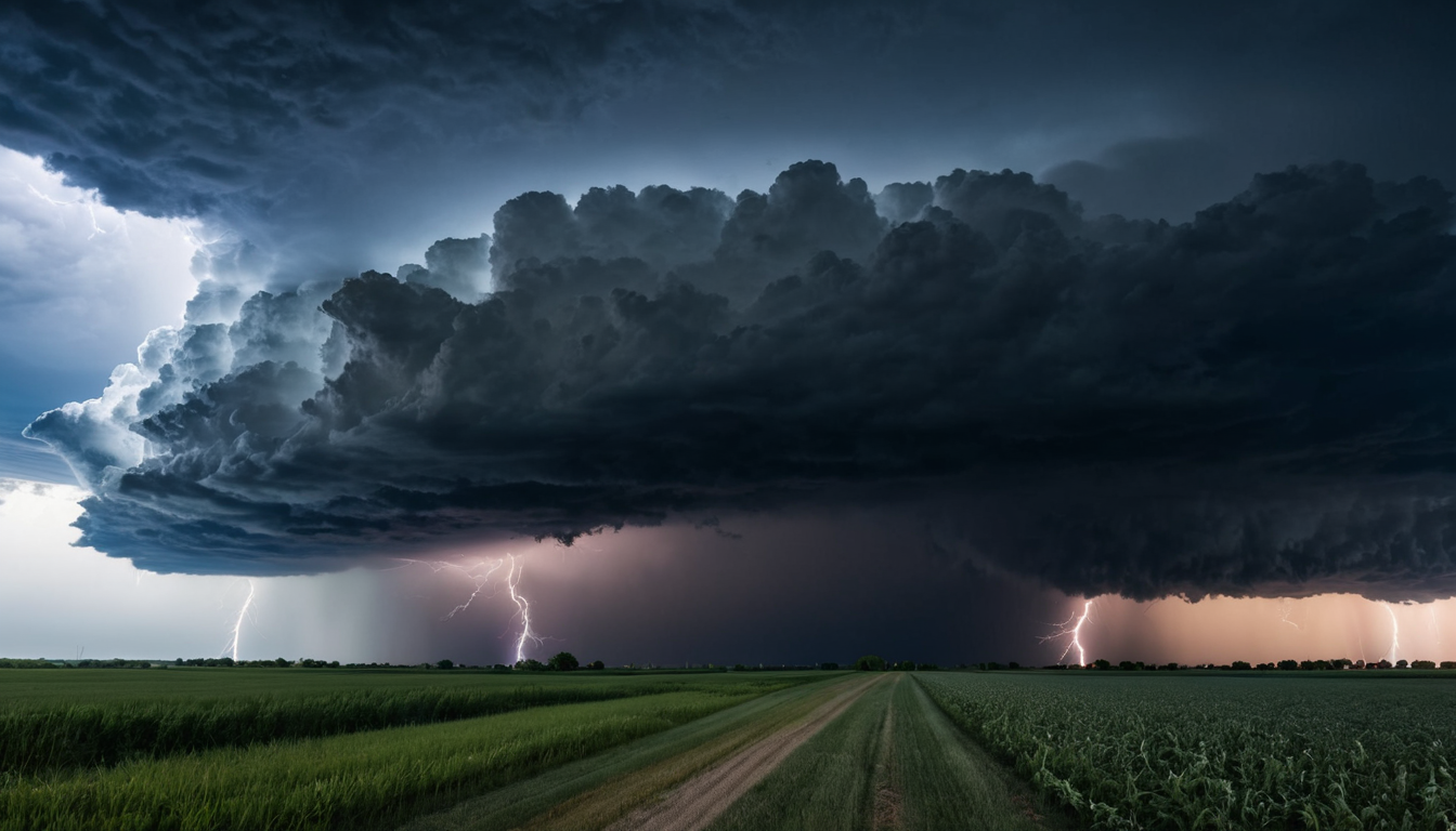
Wednesday Outlook: Surface low pressure lifting through the area will bring increased chances for showers and potentially strong thunderstorms Wednesday afternoon and night.
-
Severe Risks: While the highest probability for severe weather currently focuses south of Illinois (from Texas into the Ozarks), some stronger cells capable of marginally severe hail and wind gusts could develop along and south of the I-72 corridor on Wednesday evening.
Heavy Rain and Drought Relief
Confidence is high that the region will see beneficial rainfall throughout the week, offering some relief to ongoing drought conditions.
-
Totals: There is a nearly 100% chance that the entire area will receive at least one inch of rain through next Sunday morning.
-
Higher Amounts: For areas along and south of a line from Rushville to Rantoul, there is a 50–70% chance of rainfall totals exceeding two inches.
Warming Trend Followed by a Late-Week Front
Temperatures will trend above normal starting Tuesday as the region moves into a much milder air mass. However, the active pattern will likely continue through the end of the week. Another round of thunderstorms is possible Friday night into Saturday morning before a strong cold front eventually sweeps through, returning the area to cooler and drier conditions by early next week.
Residents are encouraged to keep a close eye on the forecast as the specific timing and intensity of the midweek storm systems come into better focus.